Import geospatial data, record what you find and follow your team in a shared expedition. With the map, the roads, the rivers and the elevation downloaded to the device, the work carries on even where there is no signal.
FilesKML, KMZ, GPX, GeoPackage, GeoPDF, GeoTIFF and TairuDB imported with no limit on the number of files on the device, in every expedition.
OfflineMap, roads, rivers, elevation and records downloaded before you leave keep working where there is no network.
Web*Follow expeditions, upload files to the cloud and edit records from the browser, on the Online or Realtime plan.
QGIS
Import and export vectors and imagery at high quality through the TairuDB plugin.
Highlights
A living expedition for people who work outside the office
Tairu Maps brings together data import, routing by road and by river, tracking, detailed records, geometry drawing and sharing in a single experience.
Unlimited file import
GeoPDF, GeoTIFF, KML, KMZ, GPX, GeoPackage and TairuDB, with no limit on the number of files. Each element can become an editable record, or the whole file comes in as a single layer — the way to go for large files. WMS/WMTS/WFS geoservices are added by URL, with an offline cache, and a ready-made catalogue gathers public services under six themes.
Routes by road and by river
A route along real roads, with distance and an estimated time from the average speed you set — and, in remote areas, along the riverbed. With the regions downloaded, both calculations run with no connection at all. Save the route as a record with one tap.
Element manager
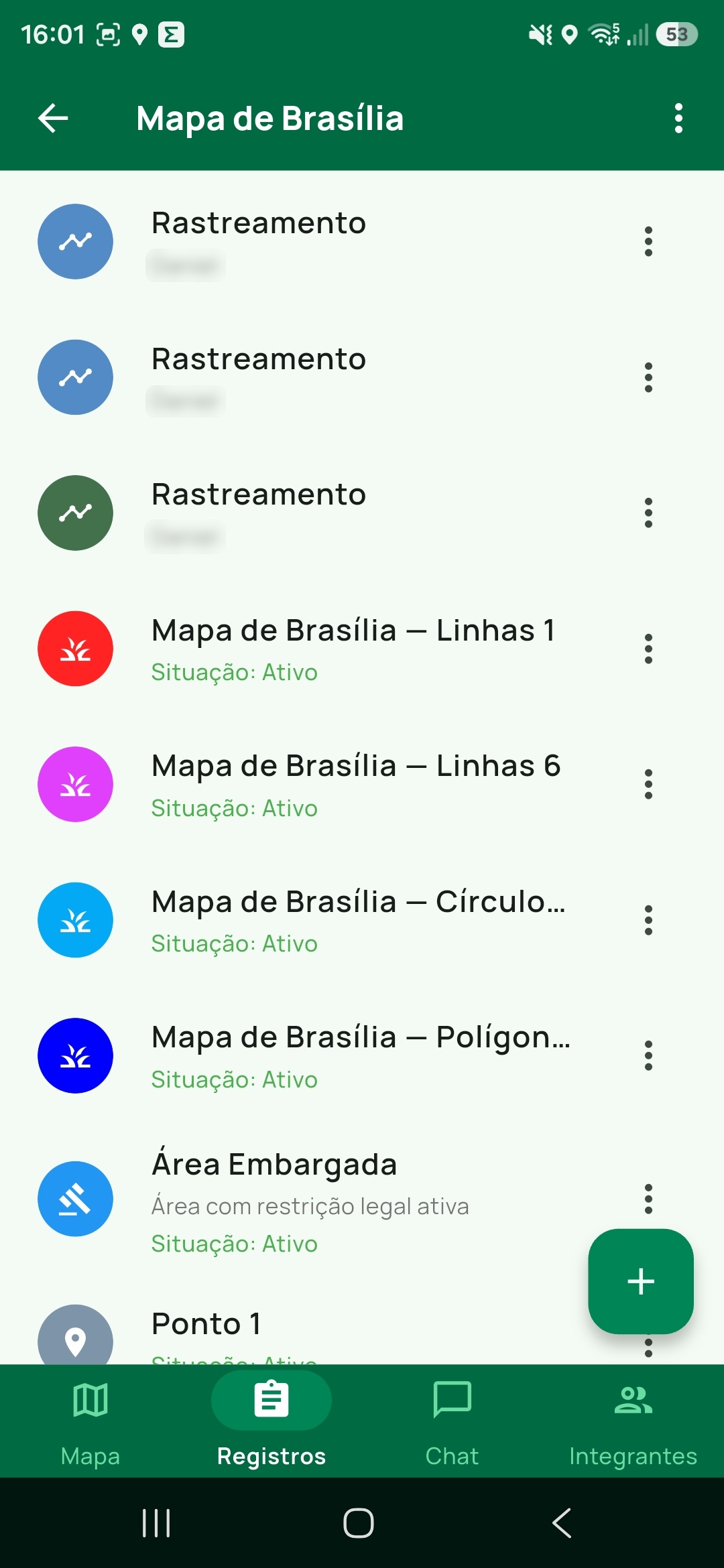
One screen for everything the expedition holds, with search, sorting and visibility. Organise records into groups and subgroups with a colour and an icon, and filter vector layers by attribute to see only what matters.
Base Maps and technical layers
XYZ and vector Base Maps, contour lines and the GRG grid, with an adjustable drawing order. Each layer has its own opacity and visibility, and the vector map follows the app's light or dark theme.
Drawing geometries
Create and edit points, lines, polygons and circles right on the map, each with its own colour and weight. Every geometry you draw becomes a record of the expedition, with attributes and photos like any other.
Tracking and current position
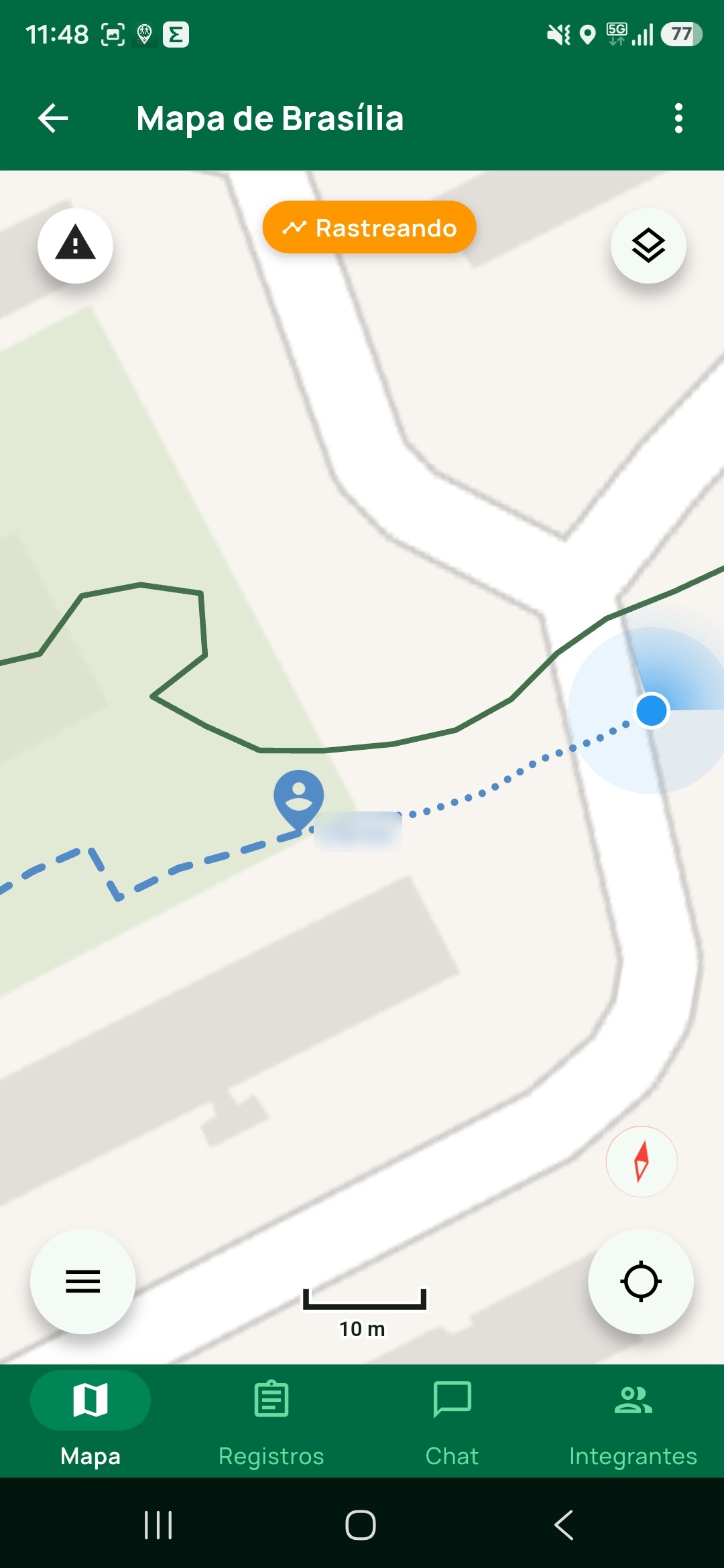
Movement history with capture adjustable by time and by distance, which keeps running with the screen off. The position of the other members appears on the map*, and a long press shows the coordinate and elevation of that point.
Point-to-point navigation
Build a sequence of destinations and the app moves on by itself as you reach each one, with an alert that works with the phone in your pocket. Bearings by true or magnetic north, with the declination computed for your location.
Elevation and track profile
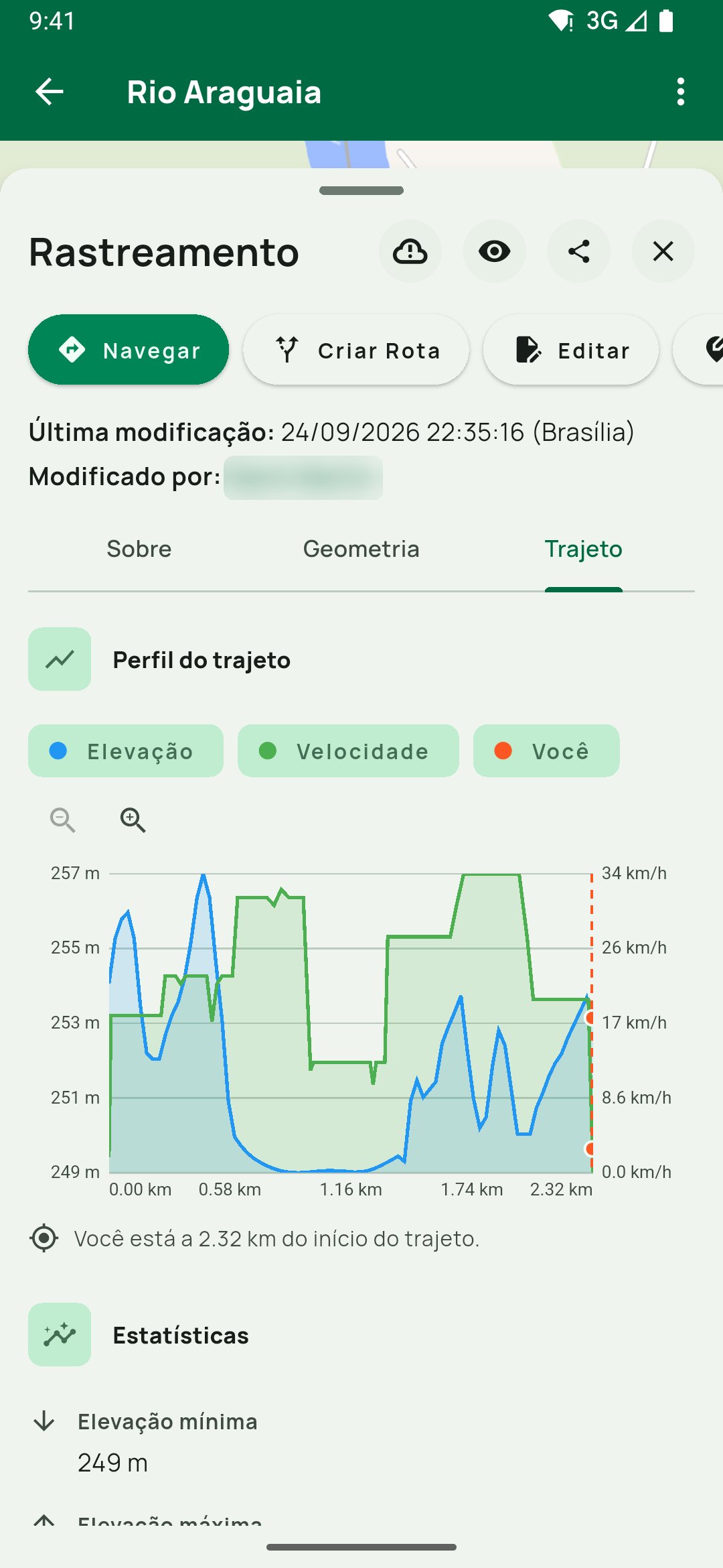
Every line and every polygon opens a Track tab with the elevation profile and the accumulated climb. Elevation comes from a public terrain model and is downloaded together with the offline area — the profile works with no internet either.
Complete records
Document places, actions and people with photos, attributes and geometry. Photos are stamped with the date, time and coordinate — and a whole batch can become records positioned by the GPS data in the images themselves.
Emergency alerts*
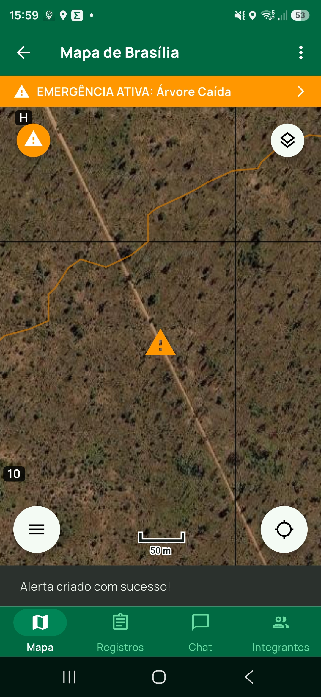
Raise an alert in a risky situation and every member gets a notification on their device. The alert stays on the map with its status, and the panel shows who is responding.
Team, roles and chat*
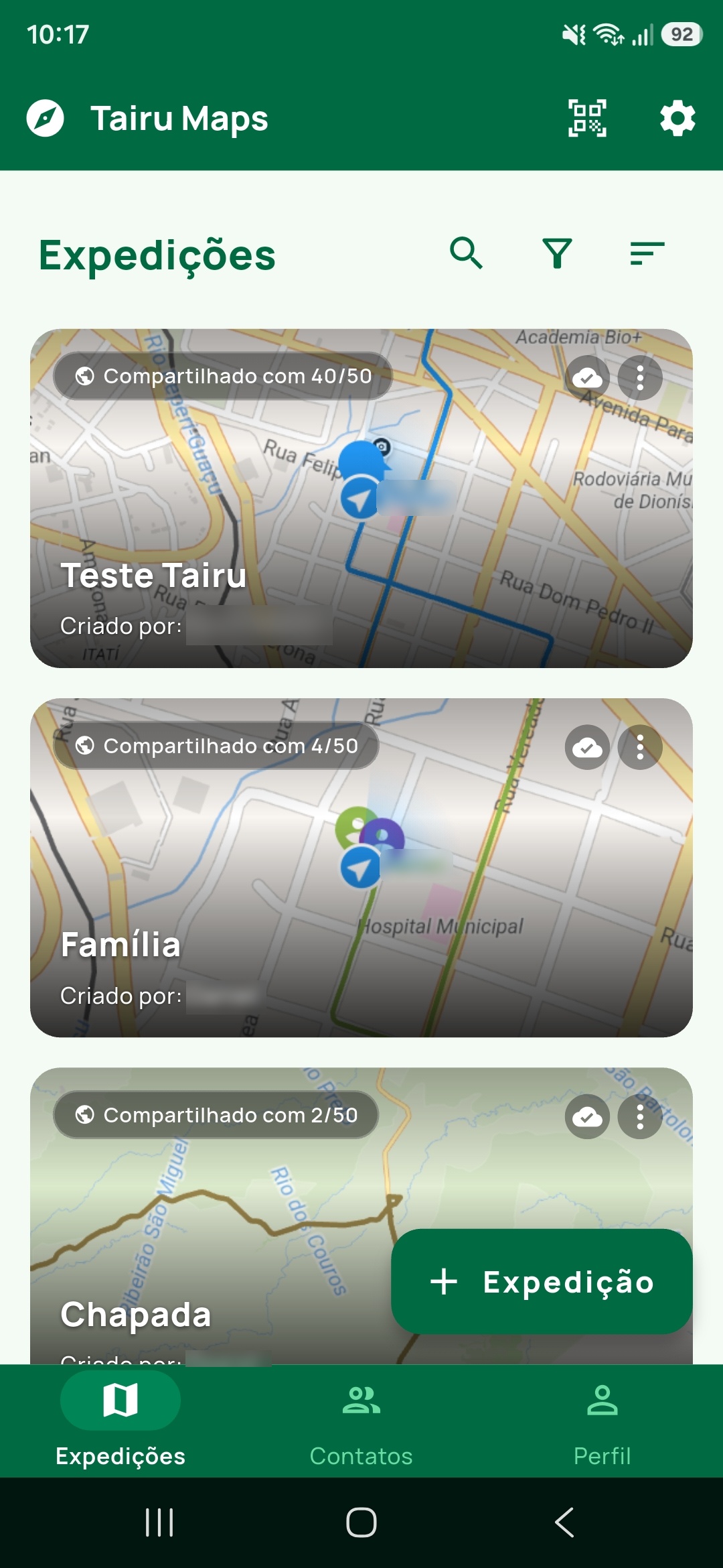
Share expeditions with owner, administrator and user roles. Invite by link, code or QR Code, with an expiry date and a usage limit. The group conversation and the one-to-one ones sit next to the map.
Export, backup and the Tairu Package
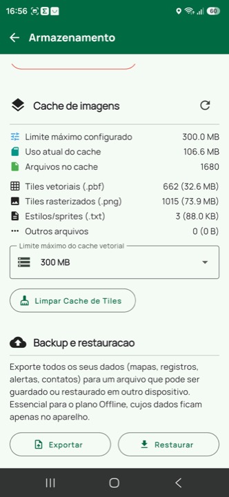
Export to KML, GPX or GeoPackage — the last one with geometry, attributes and styling, ready for QGIS. The Tairu Package carries records with their photos into another expedition, and the weekly backup keeps everything for another device.
* Features available on the Online and Realtime plans.
Offline
The expedition keeps working with no signal
What you download before leaving stays on the device: the map, the roads, the rivers, the terrain elevation and your records. The Offline plan is free and never depends on the cloud.
Save the map before you lose signal
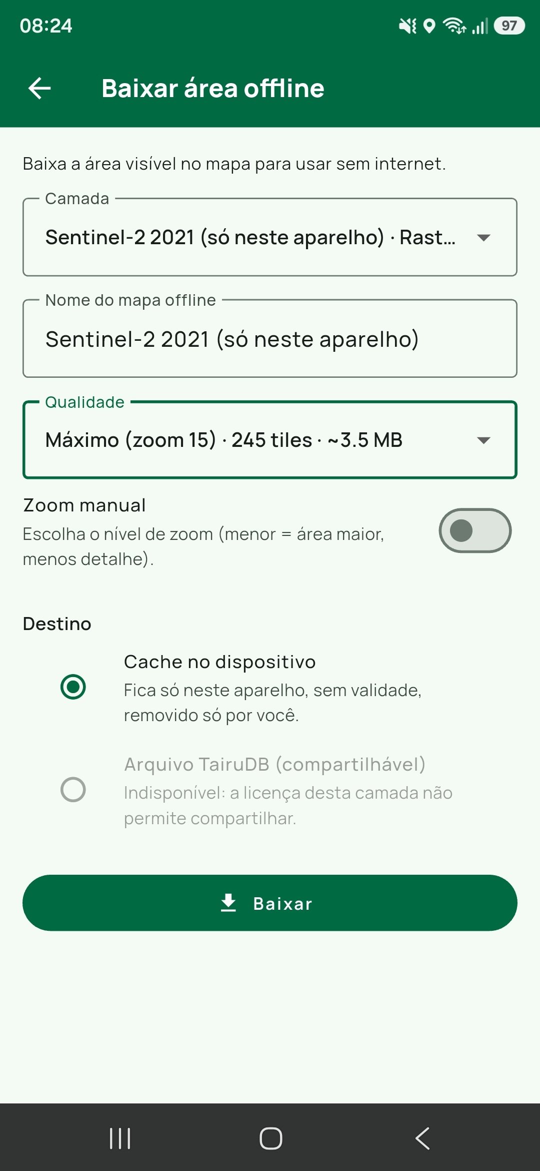
Download the area on screen with the layers currently showing: the Base Map in use, satellite imagery included, and the image Geoservices on top of it. Before it starts, the app shows the tile count and the estimated size.
A layer that is covered up or has no content in the area is left out, with the reason written in the list.
An estimate in tiles and megabytes, with a 200 MB ceiling per download and a manual zoom to trade a larger area for less detail.
It stays on this device only, with no expiry date: it goes when you delete the area, or when the expedition leaves the device you downloaded it on.
The route is calculated inside the device
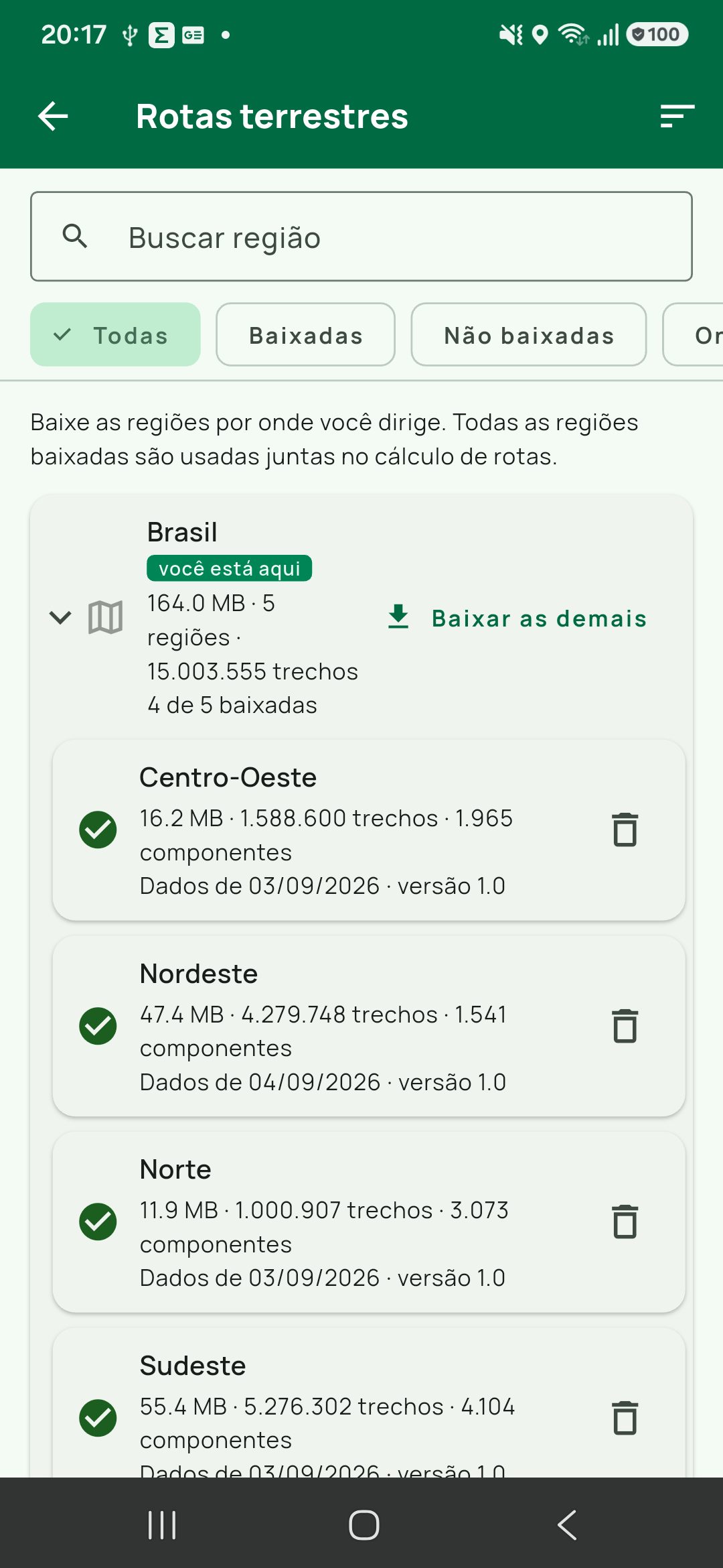
Download the roads and rivers of your region and the route is then calculated on the device itself — phone or browser — with no signal at all. Brazil comes in five regions; South America, Central America, the Caribbean and Mexico come country by country (Haiti and the Dominican Republic in a single region) — downloaded regions work together, so a route that crosses a border stays whole.
There is no calculation mode to choose: the device's own router is the only one, and without the region downloaded there is no route even with internet.
Turn restrictions and one-way streets are respected.
The river route is always calculated on the device: there is no online mode, only the Hydrographic Regions you have downloaded.
Terrain elevation comes with it
Elevation is downloaded with the offline area. In the field, any line or polygon — drawn, imported or coming from a Geoservice — shows its elevation profile with no internet, and a long press on the map answers with the elevation of that point.
Stored once on the device and used by every expedition.
TairuDB maps generated in QGIS already carry the elevation of their own terrain.
Size and a delete button under Storage and backup.
How it works
From the raw file to a shared expedition
Tairu Maps was designed for people who work with files from many sources, need to organise the information quickly and take it all into the field.
Import the right file
GeoPDF, GeoTIFF, KML, KMZ, GPX, GeoPackage and TairuDB files all enter the same workspace — as editable records, or as a single layer when the file is large. WMS/WMTS/WFS geoservices are added by URL.
Organise and check
Groups, layers, filters, sorting and records turn large datasets into clear tasks.
Prepare for offline
Download the map area, the roads and rivers of the region and the files before you leave. Terrain elevation comes along without being asked for. In the field, nothing depends on signal.
Follow along in the field
Tracking, point-to-point navigation and alerts keep everyone oriented during the operation.
Share* or export
Sync with the team, open it in the browser or export records to other mapping applications.
Ecosystem
Android, iOS, Web and QGIS working together
Use the app on the field device, follow expeditions in the browser and prepare geospatial data with the TairuDB plugin for QGIS. The interface is available in Portuguese, English and Spanish, with a light or dark theme or following the system, and coordinates can be shown in decimal degrees, DM, DMS or UTM.
Android
Download it from Google Play to use offline maps, tracking, records and files in the field.
iOS
Available for iPhone with the same field interface.
Web*
View expeditions, upload files to the cloud, create records and follow the team from the browser.
QGIS
Generate TairuDB files with high-quality vectors and rasters straight from QGIS, and send the result to an expedition.
Plans
Start offline, connect when you need to
Tairu Maps keeps local use separate from the collaborative features so that each team can choose the right level of syncing. Every account can activate, once, 7 free days on the Realtime plan, with every feature unlocked and no card required; access then moves to Online for 7 days and, after that, to Offline.
Offline
A local plan for working with data saved on the device itself.
Unlimited expeditions, with map files and offline areas kept on the device.
File import and local records.
Background tracking.
Backup to a file, manual or weekly and automatic, with restore.
Online
Cloud syncing to share expeditions and location with the team.
Local and cloud storage, syncing every 5 minutes.
Sharing of expeditions, content and members.
Emergency alerts for mobile devices.
Web version.
Up to 20 members per expedition.
Up to 5 shared map files per expedition, totalling 100 MB in the cloud.
Realtime
Full access for expeditions that depend on immediate follow-up.
Everything in the Online plan.
Position and content updates in real time.
Up to 50 members per expedition.
Up to 10 shared map files per expedition, totalling 200 MB in the cloud.
The Online and Realtime plans can be purchased in the app, with the subscription processed by the Apple App Store or the Google Play Store.